From iconic named trails to a network of minor footpaths, North and Mid Devon is home to a fantastic selection of walks. Whether you want to soak up the scenery on a low-intensity stroll or test your limits with a coastal hike, this region of England promises satisfaction for walkers of all abilities.
The South West Coast Path (SWCP)
The South West Coast Path is the most popular long-distance national trail in this region. It begins in Minehead and follows the coast, with occasional forays inland, for 124 miles to the Cornish border before completing its 630-mile journey round the Cornwall peninsula to Poole Harbour in Dorset.
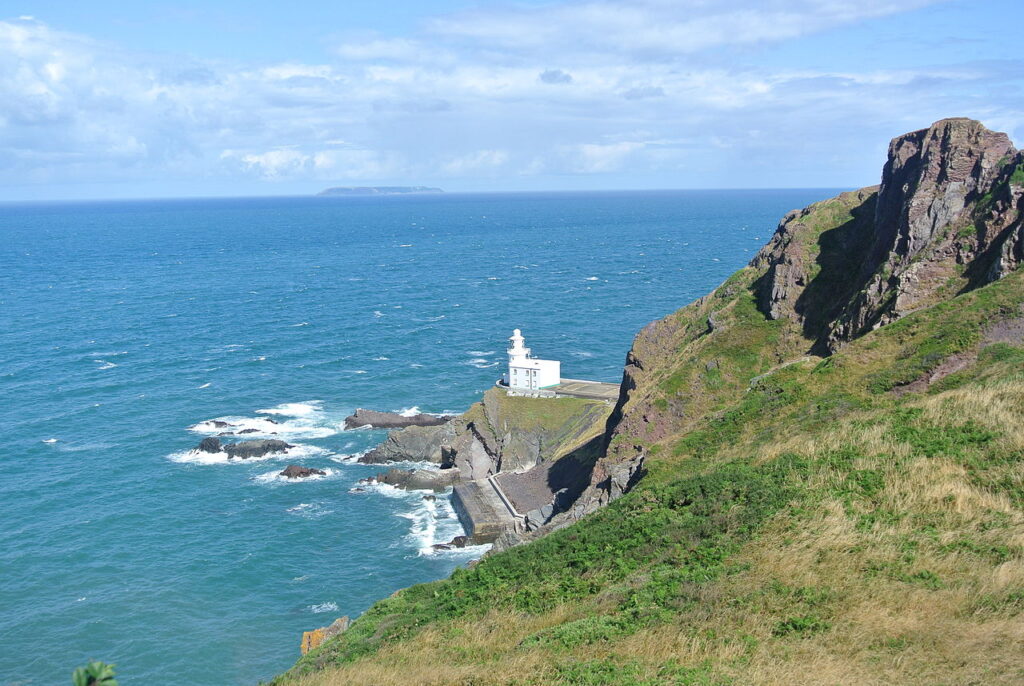
The North Devon section is considered by many to be the most beautiful, as well as the most challenging, of the entire route. All keen walkers who visit Devon will do parts of the coast path, most utilising the inland footpaths to make a circular trip or doing one of the ‘bus-assisted walks’ popular with those seeking a less vigorous experience.
Coast to Coast (Two Moors Way)
Devon’s Coast to Coast (still mostly signed as The Two Moors Way) is a must-walk for all ages. It is so varied and so beautiful, you hardly notice your tired legs. The longest stretch – and it is indeed a tough one – is a little over 13 miles across Dartmoor with no escape route, but after that you can always arrange shorter days.
The Mid Devon section is particularly enjoyable because so few walkers do it. From Drewsteignton, on the northeastern fringe of Dartmoor, you walk through farmland, with some woodland, through Witheridge and Knowstone and into Somerset to meet Exmoor at Tarr Steps.
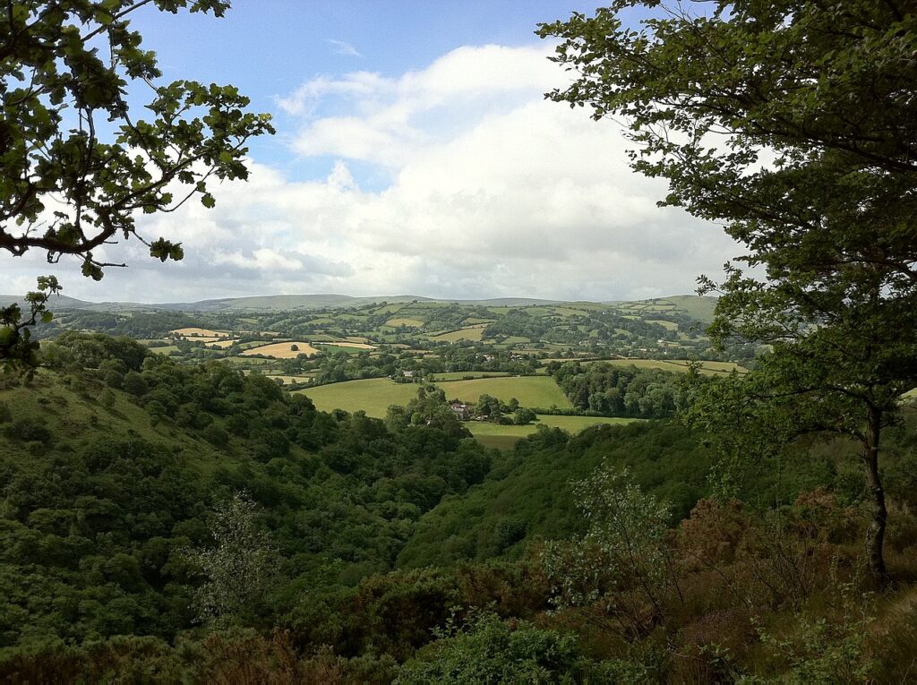
The Two Moors Way runs from Ivybridge on the southern edge of Dartmoor to Lynmouth on the North Devon coast. Now including an extension to link it to the south coast at Wembury near Plymouth, the whole walk is 117 miles in length.
Brownsham to Clovelly
This stroll takes in some of the most beautiful natural landscapes in Devon. Leave your car in the National Trust carpark at Brownsham and take the path through Beckland Woods, following the signs to Mouth Mill; it has some ruined buildings from the old lime kiln in which you can shelter if it’s raining, and a pebble beach with the sea-sculpted Blackchurch Rock in view. The rock formations are splendid, like multi-tiered sandwiches laid on their sides.
About a third of the way along you’ll pass the beautifully carved ‘Angel Wings’ seat, put there by Sir James Hamlyn Williams in 1826. It is one of several shelters he constructed around the estate. This location was particularly special to him as, from it, he could look across the bay to where his daughter, Lady Chichester, lived.
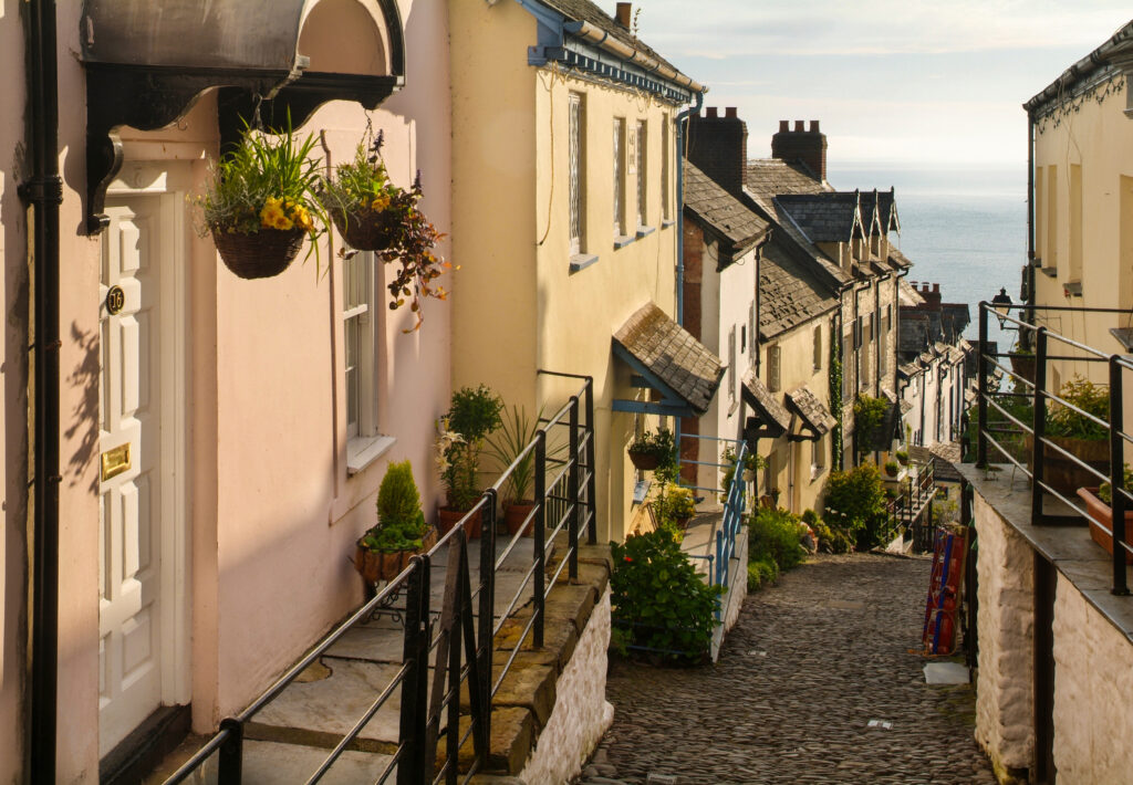
Soon you’ll get glimpses of Clovelly tucked into the cliffs and have a choice of routes into the village: either the footpath that leads you to the centre of the village or the road, or a steep walk downhill, to emerge near the Red Lion hotel by the quay. The Red Lion has two bars, both serving local food and drinks.
Combe Martin Loop
This walk is mainly along quiet lanes, though with very few level stretches. It gives you great views of the coast and down to the lovely cove of Wild Pear Beach. The walk also takes you near some reminders of the Combe Martin’s silver-mining past.
At the point where the path starts to climb steeply towards Little Hangman, look for a turning to the right where you’ll join West Challacombe Lane, passing West Challacombe Manor, which is now owned by the National Trust and let as self-catering holiday accommodation. This is a beautiful 15th-century manor with a splendid Great Hall, which retains its medieval roof. No-one is certain what it was used for, but it could have housed the miners brought from Wales and the Peak District.
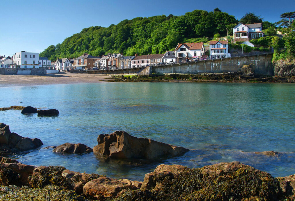
The lane leads to Combe Martin’s main street (King Street at this point) so if you want to cut your walk short here you are less than half a mile from the starting point. For those who wish to walk the full length, the rest of your journey will include a stroll along the town’s charming High Street.
The Hunter’s Inn and Trentishoe Circuit
This tough walk brings you through some of the most sublime and varied scenery in Exmoor. Perhaps the most sublime, so you won’t mind your bursting lungs as you climb the hills or your knees aching as you slither down them. It takes you through wooded valleys and along a superb stretch of coast path, purple with heather in the summer, close to the cliff edge (so if you’re afraid of heights, this might not be for you). There’s also the opportunity to visit little Trentishoe church and its resident bats.
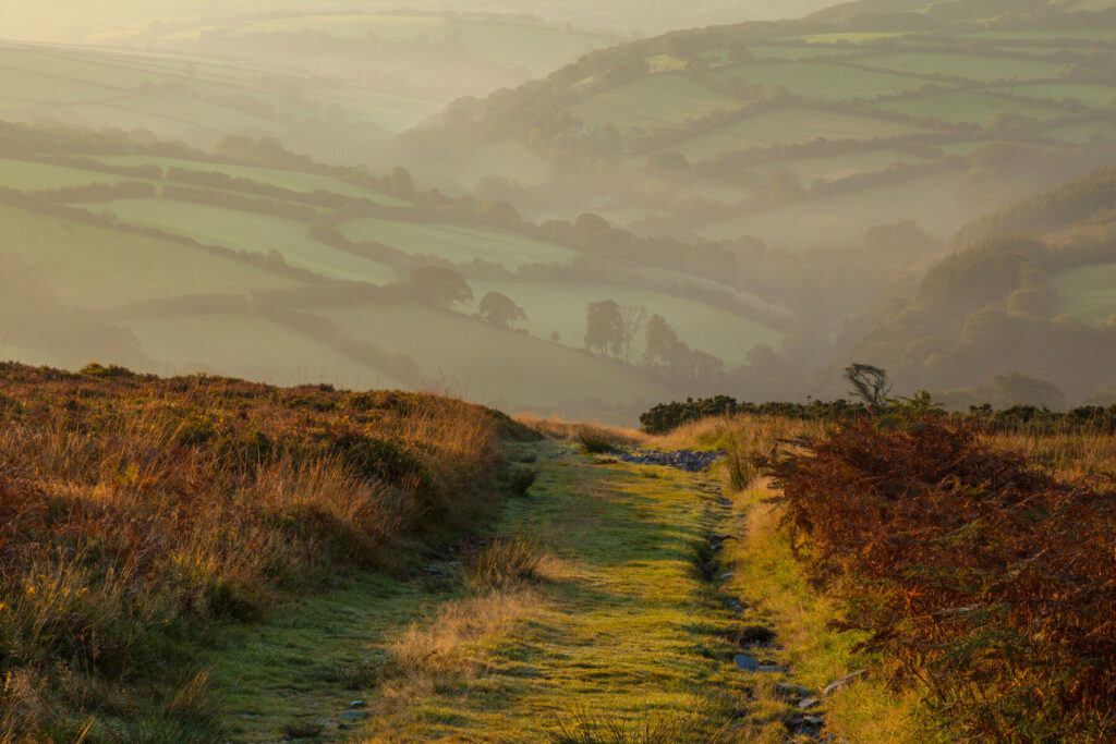
The traditional walk has the long descent down a rough and stony path, though often with steps; many people find it easier to go uphill on rough terrain, in which case just reverse your route; it’s very easy to follow.
Hollerday Hill and the Valley of Rocks
A track goes from beside Lynton’s town hall and winds up to the site of Hollerday House, over the top of Hollerday Hill and on to the Valley of Rocks. Although it is a steep climb, Hollerday Hill and the scarcely visible remains of the house are a wonderfully peaceful place with great views along the coast to Foreland Point.
From the terrace originally at the front of Hollerday House, bear left and follow the level path, parallel to the sea; you will soon see the first sign of the rocks, a monolith aptly known as The Castle. Other rocks, strewn around, have been given names: Rugged Jack, Devil’s Cheesewring, Middle Gate and Chimney Rock. The path zigzags down to the flat valley bottom, where feral goats and Exmoor ponies graze.
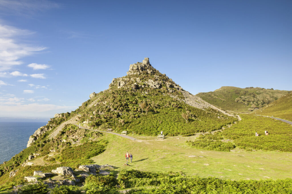
The Castle (Castle Rock) at the bottom can be climbed by a steadily rising path with superb views to the west and the sheer cliffs to the north bringing home the scale of this striking landscape. It’s considered by a Lynton resident to be the area’s best kept secret: ‘Swimming is a challenge at low tide, but great at high tide for confident swimmers. And it gets the sun for most of the day.’
Four Hamlets
This circular walk from Colebrooke links four hamlets – Colebrooke, Coleford, Knowle and Penstone – all once part of the Eggesford estate. This is quintessential Devon, with quaint thatched cottages and huge views across rolling pasture. The walk is on good paths with some gentle hills but a couple of sections can be muddy. Coleford has a pub with a small garden that’s perfect for a rest – and for lunch if you time it right.
The walk starts at the door of The Church of St Andrew, which dominates the local landscape, sitting 200ft above the valley. Take the paved path that passes under the clock and sundial to go through the churchyard and then past the Parish Hall, the Old Post Office and Bell Inn Cottage.
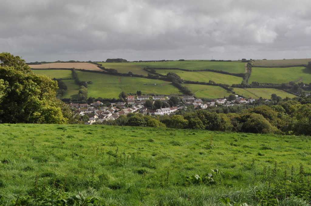
The track becomes a footpath and, eventually, passes through a gate from where there are great views across the valley. Keep straight ahead then turn right after the next field boundary and pass through two more gates.The path continues to descend; in the field before the railway, turn left across the middle of the field to reach, in the far corner, a tunnel under the railway.
The rest of the walk includes winding stream paths, two working farms and the beautiful Chapel of St Boniface.
Hele to Ilfracombe
By walking from Hele you can approach Ilfracombe from its most flattering side as well as taking in Hillsborough Fort on the way. It’s a treat of a walk, short but with steep ups and downs, and some wonderful views.
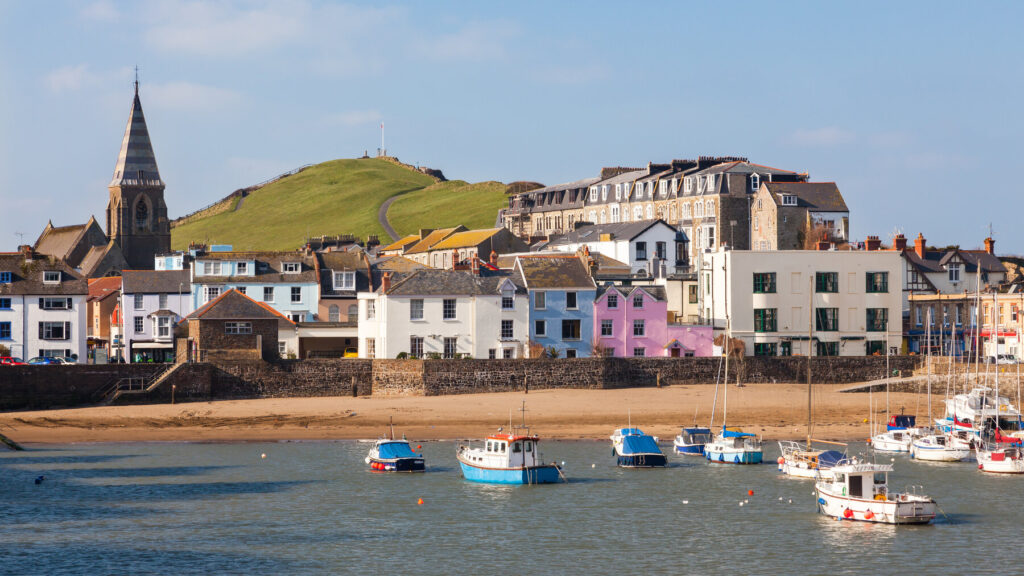
From Hele Beach take the coastal path up to Beacon Point. This is a tough climb (made easier with steps) but the view of Ilfracombe from the top makes it all worthwhile. On a sunny day it’s just gorgeous: the little squared-off harbour full of boats is backed by pink-, blue- and cream-coloured houses, behind which tower the incongruous cones of Madonna’s Bra. The craggy green Lantern Hill provides a contrast on the right. After your descent to Ilfracombe, walk up Fore Street to Portland Street, from where regular buses run to Hele Bay.
More information
For more information on North and Mid Devon and maps of these walks, check out our guide:
