The sights, sounds and flavours of the Outer Hebrides are reason alone to travel to these islands. Yet, along with photographs, you are likely to take away memories of the people you meet – warm, generous and with a keen sense of their culture and identity.
Mark Rowe , author of Outer Hebrides
Right up in the top left-hand corner of Britain, you’ll find the Outer Hebrides. Straddling the edge of Scotland, they look the part: high mountains, thrilling cliffs, lonely lighthouses and huge empty landscapes. From long summer days to dark, wild winters, these are islands of extremes that offer a unique trip whether you want a short break or a longer holiday.
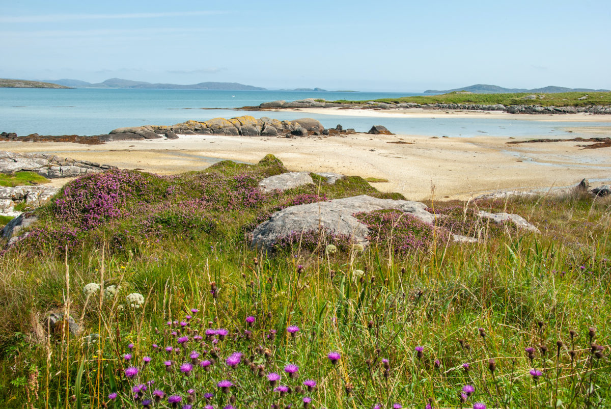
Adrenalin lovers are in for a treat: you can indulge in mountain biking, kayaking, coasteering, rock climbing, scuba diving and much else in some of the most dramatic and wild locations the UK has to offer, from the moonscape of The Bays, to the elemental coastline of Uig. Superb walking awaits in the hills of Harris; this is also the best – and easiest – place in the UK to see wildlife, from red deer to puffins, golden eagles to dolphins. On top of that, gorgeous beaches provide Robinson Crusoe moments where your footprints are the only ones to break the fine white sand.
When you’re done with the outdoors, you can enjoy local whisky and great food, from homemade chocolate brownies to fine dining that draws on local lamb, venison and seafood. You really haven’t tasted salmon until you’ve eaten it here. Explore art galleries that blur into cafés, where your artist in residence may serve you oatcakes and salmon. Relax at the end of the day in great youth hostels or – for a treat – a luxury self-catering joint straight out of the Grand Designs portfolio.
For more information, check out our guide to Outer Hebrides
Food and drink in Outer Hebrides
It’s fair to say that a food revolution is taking place in the Outer Hebrides and that cuisine has come a long way in a short time. Long gone are the days when islanders would catch seabirds and boil them up for soup.
While filling and calorific meals of the meat and two veg variety still predominate, recent years have seen the emergence of a trend for fine dining and for using island produce rather than imports from the mainland. Some eateries tend to over-egg matters: there are only so many ways to skin a cat, and you may be left wondering how many more ‘towers’ or ‘gateaux’ of Haggis you will encounter (cat or cat skin, just to be clear, are not among the ingredients to be found in Haggis).
Food
On every island, you will have the choice of meat from animals reared locally or fish caught just off shore. Venison is common and drawn from island herds of red deer. Stornoway black pudding was given Protected Geographical Indication status in 2013, putting it on a par with Yorkshire Wensleydale cheese or Cornish sardines.
Other dishes you will often come across include cranachan, a traditional Scottish dish of oats, cream, whisky and raspberries, and crowdie, a soft and crumbly cream cheese with a slightly sour taste that is said to mitigate the effects of drinking too much whisky.
Oatcakes are another ubiquitous offering, usually served with salmon as canapés or with cheese as a dessert. Several curing and processing outlets have taken the finishing of salmon to something approaching an artform. You are unlikely to taste better salmon in the UK than you do on these islands.
Cafés and restaurants are also increasingly upping their game and are geared up for special dietary requirements. On the subject of the former, a curious feature of the Outer Hebrides is that the elemental nature of the landscape is in inverse proportion to the cosiness of its cafés.
Drink
Every pub and hotel bar has an extensive selection of whiskies. For now, there is just the one single malt, from Abhainn Dearg distillery in Uig on Lewis, which will be followed by a concoction in preparation at the new Isle of Harris Distillery in Tarbert.
Beers from the Hebridean Brewery Company in Stornoway include Clansman (a golden bitter), the ruby-coloured Islander, Celtic Black (a dark porterstyle ale), and Berserker, a stronger India pale ale. The microbrewery phenomenon has not yet reached the islands, but craft ales from Orkney, Shetland and the Black Isle (north of Inverness) are commonly found.
A frequent misconception that the tourism authority is always eager to correct is the widely reported claim that there are no pubs on the Outer Hebrides. Stornoway has plenty, and although country or roadside pubs that characterise much of the UK are few and far between, you will find one on each of North Uist and Eriskay. Meanwhile, most hotels have bars that most definitely serve as the local pub. Most places accept credit cards but, as is the case with accommodation, it is worth checking ahead.
Health and safety in Outer Hebrides
Health
Your risk of contracting a disease or falling ill is the same as on the Scottish mainland, and tap water is potable everywhere. Many walkers like to refill their bottles from streams out on the hills. If you do so, there are general principles you should apply: never drink from water below human habitation, and never from still lochans, only fast-running burns. If you’re not confident, consider adding a chlorine tablet to the bottle, as you might elsewhere in the world.
Ticks
One animal you should be mindful of is the tick, which is attracted to human blood and lurks in wooded, bushy and moorland areas. Ticks should ideally be removed as soon as possible, as leaving them on the body increases the chance of infection. They should be removed with special tick tweezers that can be bought in good travel shops. Failing that, you can use your fingernails: grasp the tick as close to your body as possible and pull steadily and firmly away at right angles to your skin.
One nasty surprise ticks appear to be increasingly transmitting is Lyme Disease, a bacterial infection often characterised by a circular rash and/or flu-like symptoms, and muscle and joint pain. The incidence of Lyme Disease is on the rise across the British Isles, including the Outer Hebrides. The NHS provides good information.
Midges
Unfortunately, the pesky wee fellas are here, usually from late May until September. That said, they are not as ubiquitous or bothersome as they are in Argyll or the central Highlands. If you sit in an open place for any length of time then they will certainly descend upon you, but in this part of the world a breeze of some kind or another usually comes along soon enough to keep them bearable.
You will rarely need recourse to a head-net of the kind that is so commonly used by walkers on Skye. It may or may not be comforting to know that while at least 35 species of midges have been identified in Scotland, only five species, and only the females, actually bite; that they are at their worst after nightfall or when there is cloud cover; and that they dislike bright sunlight. Repellents of varying effectiveness can be bought from your local chemist or outdoors shop.
Safety
The Outer Hebrides is an extremely safe place to visit. Violent crime is very rare indeed and in 2013–14 the police recorded precisely one instance of housebreaking. Bigger hazards are likely to be overestimating your driving capabilities on some of the narrow roads or avoiding sheep or deer that dart in front of your vehicle.
Most activities on the islands involve the great outdoors, so you should be mindful of the volatile weather and the often sporadic signal coverage for mobile phones. For walkers and climbers, sheer and exposed cliffs have a habit of springing themselves on you, particularly around Ness, Uig, Harris and South Uist, where they can rise up abruptly from sea level with startling contours. You should also take care walking on peat bog, which is far from a constant surface and can conceal eroded channels and buried river courses.
You should always ask locally about which beaches are safe for swimming. If kayaking, strongly consider going with a guide. The coastguard says that 86% of callouts on the islands involve visitors.
You will occasionally see signs for quicksand on beaches, including those at Eoropie on Lewis, Scarista on Harris and at Tràigh Tuath on Barra. The risk from quicksand is not of disappearing into the earth in the style of horror films but of drowning as the tide comes in. The Stornoway coastguard advises that you apply common sense: if you feel sand shifting under your feet, walk swiftly to firmer sand. If you encounter difficulty, call the coastguard on 999 immediately.
Travel and visas in Outer Hebrides
Visas
The Outer Hebrides are part of the UK, so UK, and at the time of writing EU, nationals do not require a visa. Visitors from the United States, Canada, Australia and other countries need only fulfil the procedures required of them at any UK port of entry before freely visiting the islands. After the UK leaves the European Union, documentation requirements for EU citizens may change. Check before travelling.
Getting to the islands
A few preconceptions need to be addressed when it comes to travel to the Outer Hebrides, not least of which is the presumption that they are located beyond the back of beyond.
Although the islands are one step further than Skye and Mull, the travel is not particularly onerous, and in any case the old adage of the journey being part of the experience certainly applies. The drive to the ferry ports on the mainland is extremely beautiful, especially the northerly routes to Ullapool or through Skye to the port at Uig.
By sea
The majority of visitors to the Outer Hebrides arrive by ferry. CalMac enjoys a near monopoly of maritime services. CalMac operates five services from the mainland to the Outer Hebrides. For the latest timetables, visit the website. It’s worth bearing in mind that while departure times are fixed, ferries do occasionally leave ahead of time to keep clear of incoming bad weather.
Take the Ullapool–Stornoway (Lewis) service if your holiday is based on Lewis; it can also be used for reaching Harris overland once arriving in Stornoway. The Uig (Skye)–Tarbert (Harris) service is ideal for Harris holidays and also convenient for Lewis. The Uig (Skye)–Lochmaddy (North Uist) route is the quickest gateway to the Uists and Benbecula; note there is no land crossing to Harris from North Uist.
By air
There are three airports on the islands: Stornoway (Lewis), Benbecula and Barra, all operated by Highlands and Islands Airports. The only airline flying to the Outer Hebrides from within the UK is Loganair. Stornoway is reached by direct flights from Glasgow (up to 4 times daily), Edinburgh (1–2 times daily) and Inverness (1–3 times daily).
Travel on the islands
By car
Almost all roads are paved and in generally good condition. A network of main roads, known as the Western Isles spinal route, runs from Stornoway on Lewis all the way south, under different road numbers, to Lochboisdale on South Uist. The islands collectively have 439 miles of A, B and C roads and 302 miles of unclassified roads.
It can be expensive to rent cars on the islands, particularly in high season, when you may not get much change out of £900 for two weeks’ rental. Rentals are cheaper on the mainland, but you then need to factor in the cost of the ferry and mileage to get to Uig on Skye, Mallaig, Oban or Ullapool.
By bus
Services are generally reliable but infrequent. They reach every nook and cranny of the islands, from the remote eastern shores of Harris to the lonely townships of Uig on Lewis or the west coast of South Uist. Almost everywhere tourists might want to visit is theoretically accessible by bus. Services are single-decker buses in and around Stornoway and often minibuses in more remote areas.
By ferry
CalMac operates two inter-island ferry services. The Harris–Berneray ferry from Leverburgh to Ardmaree is the north–south link between Harris and the Uists. The journey through the Sound of Harris is beautiful and takes around an hour. Further south, a 40-minute ferry ride links Eriskay with Ardmore on Barra. Those connecting from one ferry to another should note that Ardmore is some 15 minutes’ drive or 8 miles, about as far as it is possible to be on such a small island, from Castlebay where you will find the ferry port to Oban.
By hitchhiking
Catching a lift is perfectly feasible and, given the friendliness of local people, can be socially rewarding. The islands’ reputation for safety means you should expect few issues; nevertheless, always use your judgement and talk to a driver before committing yourself.
One factor to bear in mind is the remoteness of townships from one another and the intermittency of traffic off the main roads: you may end up waiting a long time for one of the very few drivers headed for a particular township, and then you have no guarantee they will want to pick you up.
When to visit the Outer Hebrides
The islands on the edge of the British Isles offer great extremes – not only of interest throughout the year but also of weather. Late April to the end of June is probably the best time to visit the Outer Hebrides. The days quickly become much longer – although you are some way south of the midnight sun, it never gets completely dark in mid June – and wildlife, on a mission to breed and rear young, is at its richest.
April can often be a fine month for weather. A ridge of high pressure driven by anticyclones is a recognised, if not consistent, phenomenon across the islands at the end of May and the start of June.
July and August herald the striking spectacle of carpets of wild flowers along the grasslands, known as the machair, along the west coast. Summer also brings many outdoor events, such as Gaelic singing festivals, agricultural shows and local versions of Highland games. It can be hard to get accommodation at short notice during the summer holidays (Scotland’s school holidays run from the start of July to mid August), and there is even more pressure on car rental, with prices to match.
Autumn triggers a mass shift in the wildlife of the islands, with birds either migrating south or fleeing the approaching Arctic winter. The dark days of winter are not for the faint-hearted but bring a sporting chance of seeing the northern lights and are a superb time to see hardy wildlife toughing things out. At this season, time your visit for a break in the stormy weather and you may witness some of the most extraordinarily wild and battered landscapes you’ll ever see. The low winter sun can also show off the distinctively corrugated appearance of undulating moors and age-old farming furrows.
February and March are the prime time to witness the territorial behaviour of golden eagles, which pair-bond at this time, soaring together and locking talons in a breathtaking display. For walkers and cyclists, the same opportunities and guidance that are relevant elsewhere in the UK apply here: check the weather whatever the season, and acknowledge that a good day out in winter can be as wonderful as anything in summer.
Climate
The Outer Hebrides are regularly exposed to the extremes of wind and rain but – relatively speaking – enjoy a mild climate, with frosts rare.
Many places where you stay will helpfully print out the weather forecast for you to peruse over breakfast: it’s not uncommon for such forecasts to predict winds to be ‘minimum 2mph, maximum 58mph’. Not only can you experience all four seasons in one day here; stand on a headland in sunshine watching hail across the sea, and it can feel as though you can experience them all at once.
In Stornoway, winter temperatures average 7°C by day and lows of 1.8°C at night; spring time temperatures climb to 9.9°C in the afternoon with overnight lows of 3.8°C. Summer’s average high temperatures are 15.2°C, though they can reach the mid-20s°C any time between April and September, with lows of 9.3°C. Come autumn, temperatures typically drop to 11.5°C during the day and lows of 6°C.
Rainfall averages 46.2 inches (1,173mm), and Harris and Lewis – with the exception of Ness – have had significantly higher rainfall over the past 30 years than the southern islands; they are also wetter than most places on the mainland, with the exception of the western Highlands, the Lake District and Snowdonia.
On average, there are 1,234 hours of sunshine per year: Stornoway sees just 50 minutes sunlight per day in December. On Midsummer’s Day the islands enjoy 18 1/4 hours of daylight, the sun rising at 04.20 and setting at 22.35, though the nautical twilight continues all night, so it doesn’t ever really get pitch black.
What to see and do in Outer Hebrides
A fascinating history
Older than Stonehenge and just as enigmatic, the standing stones of Callanish on Lewis are the most popular attraction on the islands. Centred around a single, slender central monolith, they are sited on an elevated promontory that makes a visit a truly haunting experience.
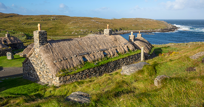
On the west coast of Lewis, Geàrrannan Blackhouse Village is a restored traditional village that provides an insight into how many people lived up to the middle of the 20th century. The distinctive blackhouses – squat, thatched and designed for humans and livestock to shelter together – are open to explore. Shiny and new, Stornoway’s Museum nan Eilean represents a technological leap into the 21st century for the islands, with interactive displays firmly oriented towards grassroots culture and first-hand accounts of history.
Pride of place goes to the display of a handful of Lewis chessmen. The tale of the Lewis chessmen discovered on a wild beach draws many visitors to Uig sands. Vast and graceful, the sands are just one point of interest here: others include mountainous skyline, dramatic coastal scenery, some great food, fine walks and important archaeological sites that emerge like apparitions on the marshy moors. The thoughtful and low-key Kildonan Museum gives a fascinating introduction to South Uist island culture and the heritage of song and storytelling.
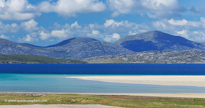
The great outdoors
Ness, the isolated northwest tip of Lewis (and of the UK), is an elemental place. There is a fine beach, a dramatic lighthouse overlooking towering cliffs, and a community with a strong sense of local identity. The watershed between Lewis and Harris is marked by the North Harris Hills, a range that forms an ancient barrier between the two ‘islands’. This is fantastic walking territory.
On a clear day, a summit climb affords views of the entire island chain and the west coast of Scotland. In rain, the landscape is transformed into a waterworld. The waterworld landscape of North Uist, with hills rising from the shores of freshwater and sea lochs, is enchanting, as are the islands’ north-coast beaches. If you only climb one hill in the Outer Hebrides, make it Rueval. Just 406ft (124m) high, it rises abruptly above the flatlands of Benbecula to give spectacular views of the interplay of land and water that characterises these islands.
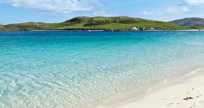
Beaches
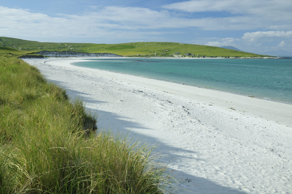
A truly mesmerising array of beaches radiates from the Sound of Luskentyre, with shell-sand bays, shallow lagoons formed by tidal waters and ever-changing dunes. Most remarkable of all is how the colours and patterns of the bays seem to change with the weather and the tides.
Often described as the Outer Hebrides in miniature, Barra has wonderful beaches and rugged inland scenery. Perhaps the most beautiful beach of all the islands – East Beach, Vatersay – can be found at the southern end of the archipelago. A huge sweep of rectangular sand overlooks a bay with shallow waters that on a sunny day really do look like the Caribbean.
Suggested itineraries
The key to exploring the Outer Hebrides is not to overdo things. The island chain may only run 130 miles or so from north to south as the crow flies, but any attempt to ‘do’ the whole lot in one brief visit is likely to leave you in need of a further holiday to recover from the tiring driving – and you will miss a good deal along the way.
In any case, the islands have few ‘sights’ – such as museums or castles – in the conventional sense. A characteristic of the Outer Hebrides is that the sites are the landscapes, the beaches, the moors and archaeological ruins. The people you meet may also be part of your experience.
Unless you are staying for a good two weeks or longer, it makes sense to focus your time on one section of the islands – either Lewis and Harris, or the Uists and Barra. Here follow some suggestions for how you might prioritise your time.
With one week at your disposal, base yourself on Lewis (days 1–4) and take day trips to Stornoway and Callanish, Ness, and Uig sands plus the landscapes of the southwest of Uig, such as Mangersta. On days 5–7, explore Harris, taking in the beaches around the Sound of Luskentyre, visiting St Clement’s Church in Rodel and the Hushinish peninsula and walking up to the golden eagle observatory at Miabhaig. Spend a few hours in the small port village of Tarbert. Take a boat to either the Shiant Isles or Monach Islands (both accessible from Lewis and Harris).
If you have a second week available, spend days 8–10 exploring the beaches of the north coast of North Uist, then hike up Barpa Langass and follow the circular loop around the attractive island of Grimsay. Climb Rueval on Benbecula. Go to the Kildonan museum on South Uist and explore the lochs and paths around Loch Eynort and Loch Druidibeg.
On days 11–14, spend a couple of hours on Prince’s Beach on Eriskay and have a drink in the pub there before taking the ferry across the Sound of Barra. Roam or bask on Barra’s wonderful beaches, such as Tangsadale or Tràigh Tuath, visit Kisimul Castle and have a coffee overlooking the waters of Castlebay. Go for a walk on Vatersay above the glorious east-facing beach. Watch a flight from the mainland arrive at Tràigh Mhòr.
With the luxury of a third week, treat yourself to visiting several additional sites, such as Arnol blackhouse, and Point and the Lochs on Lewis. You could perhaps base yourself for a week in a single location, such as the Valtos peninsula in Uig, the Luskentyre area of Harris or Barra.
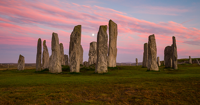
Callanish
The west coast of Lewis is the most visited part of the Outer Hebrides, visitors flocking – a relative term here – to the island’s chief attraction, the standing stones of Callanish (Calanais). Hewn from otherwise undentable Lewisian gneiss, a central monolith some 12 feet high is surrounded by a circle of 13 stones, while lines or avenues of other stones lead away to all points of the compass.
There’s a graceful symmetry to the site, enhanced by the patterning of the gneiss visible on the rough-cut surfaces of the stones. The gneiss stones are fine grained, pea-green, as thin as a finger in places but – please don’t try this, just in case – utterly unsnappable.
The stones were erected around 4,500–4,900 years ago, but the site is known to have been cultivated by farmers planting barley even earlier, around 3500BC. At the time, the climate was less wet and windy. A ring of stones with the monolith was erected around 2900–2600BC Around 2600BC, a small burial cairn was placed in the stone ring and the rows of stone that run north from the central site may have been added at this time.
By 2000BC, the chamber was encased in a cairn with cremated bones and pottery placed inside. Significant changes happened from 1500BC onwards: farmers ploughed the area and peat smothered the site and by the time it was excavated in 1857, the peat had settled five feet deep.
You can take your pick from the many ideas put forward to explain what Callanish represented; the current prevailing view is that the site is tied into lunar events. Research shows how, at certain points in its cycle, the moon skims along the silhouette of the skyline of hills that make up Uig and Great Bernera to the southwest, an outline known as Cailleach na Mointich, the Old Woman of the Moors, which is thought to depict a sleeping woman.
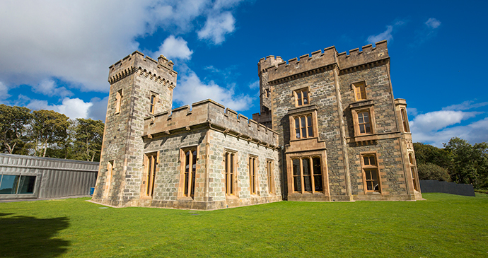
Lews Castle
Based on the ground floor of the castle, the Lews Castle Museum and Archive (Museum nan Eilean) opened in 2016 and, despite the rather unimaginative name, it represents a quantum leap for Stornoway. A series of galleries and interactive displays tells the history and present of the islands.
With its emphasis on humanising the stories of fi shing, farming and song, it strives successfully to bring the island landscapes to the fore. Centre stage is given to six Lewis chessmen, on long-term loan from the British Museum in London. Captions are in Gaelic and English. Deliberately and intriguingly, they do not always say the same thing, as the intention is to appeal to two distinct audiences – Gaelic-speakers and English-speakers.
The castle building, which glows a gentle honeyed colour on a sunny evening, has had something of a mixed history. When Lord Leverhulme offered Lewis for sale, Stornoway and the castle were the only parts that the community were in a position to buy. The town spent several decades working out what to do with the castle – it served as a further education college for many years – while it sat cloaked in woodland.
The landscaped grounds of Lews Castle are a delight, not least because they are home to that rare thing on wind-blasted, peat-dominated Lewis – a mature woodland. A walk through the western and southern reaches of the estate is well worth the time; pick a map with various walks at the Woodlands café. The woods were planted by Sir James Matheson shortly after he acquired Lewis from the Seaforth family, using seed from the Far East and the New World, and planted in soil imported from the mainland.
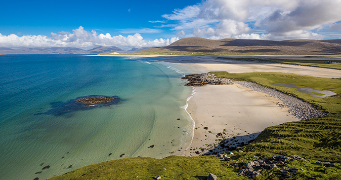
Luskentyre
The first views of Luskentyre sands and the Sound of Taransay take your breath away. From the north, the spectacle opens up as you crest the A859 as it flicks west along a passage blasted out of otherwise impregnable Lewisian gneiss.
Coming from the south the backdrop of the North Harris Hills is positively cinematic. Either way, it’s no surprise that Luskentyre is regularly cited in pantheons of the world’s great beaches. The route described here runs north–south from Tarbert to Leverburgh and Rodel, but can just as easily be explored in reverse.
Beginning some 8 miles southwest of Tarbert, the sands of Luskentyre herald an area of beaches and headlands that reaches 7 miles from east to west and 6 miles from north to south and is only curtailed by the rocky southern shores of Harris 3 miles north of Leverburgh. At low tide, the various beaches along the western shoreline seem to become conjoined and laced with rivulets of retreating and advancing water and ever-shifting dunes.
The eastern headwaters of Luskentyre are a brackish world of saltmarshes characterised by curious and extremely photogenic clumps of seaweed that resemble inflated lily pads. These are turf fucoids, small seaweeds that coagulate together to resemble mosses in extraordinary and mesmerising patterns.
The whole of Luskentyre is a Site of Special Scientific Interest and the sand flats are rich in juicy foods such as ragworm, cockles and laver shells. At the head of this magnificent seascape is Loch Fincastle, which is a good spot for dragonflies in summer. Right by the loch and close to the high-tide mark, a turning signposted for Luskentyre (Losgaintir) leads along an unclassified road to the township of the same name. This 5-mile track skirts along the northern shoreline with several places where you can stop and walk. There are excellent rockpools along here for children.
The road winds past a romantically positioned cemetery and descends to a car park with public toilets. A short walk over the dunes here deposits you on to Tràigh Rosemol, an exquisite and almost perfect rectangle of white sand that gazes across to Taransay and, to the north, far along the Hushinish peninsula.
Looking south, the beach appears to converge on a vanishing point; in reality, tides permitting, you can walk south and then west around the dunes for a mile or so, back past the cemetery and make your way up the rocks to the road at one of the points where the two meet. The Sound of Taransay at the mouth of the sands is one of the best places on the islands to see eider.
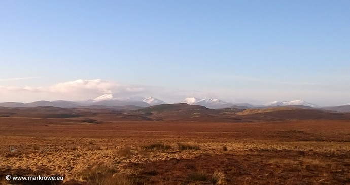
Ness and the Butt of Lewis
Ness is the name given to a large and sprawling collection of communities which amalgamate in the northwest corner of Lewis. Home to 1,100 inhabitants, it’s a surprisingly busy part of the island that runs for 3 miles both north–south and (in a grand arc over an expanse of machair) east–west.
The main places of interest are found around the harbour at Port of Ness (Port Nis) in the north and the community of Eoropie (Eòropaidh) to the west. Thrilling coastal walks are a highlight, along with a lonely lighthouse, an even lonelier church and sweeping views to the horizon in all directions. In addition, Ness can offer you a swimming pool, ten-pin bowling and a social club.
Visually the area can be slightly confusing for the first time visitor but essentially a looping ring road knits everything together and runs west from Port of Ness to Eoropie and back to the A857 via Loch Stiapabhat. Ness can be incredibly windy, so much so that you wonder how people have ever made a living here.
The sturdy harbour in Port of Ness is tucked down a slope and looks as postcard pretty as anything in Cornwall, except that you will often have it, and the beach beyond, pretty much to yourself. The harbour is the place from where each year the men of the area set sail to conduct the annual Guga (gannet) Hunt on Sula Sgeir, 45 miles northeast of the Butt of Lewis. Archaeological remains are routinely found on the exposed dunes of the west coast of Ness.
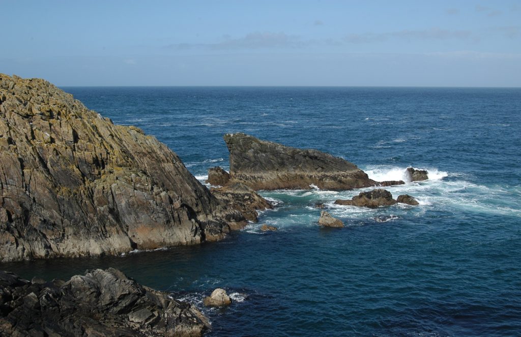
Follow the road from Ness anti-clockwise as its curves around to reach Eoropie, where you’ll find tiny St Moluag’s chapel (Teampull Mholuaidh) tucked away, 300yds down a narrow footpath squeezed between field fences. The church was built during the 12th–14th centuries on the site of a much earlier chapel that had associations with pre-Christian rituals that paid homage to the sea god Shony. Inside, a beautiful stained-glass arch of blue and yellow above the altar is hemmed in by thick-set stone walls. In 1999 the church yielded a surprise when the sacristy was forced open to reveal a late 18th-century chalice of French origin.
If you have children, your luck is in as the Eoropie dunes have one of the most wonderful play parks you could hope to find, with swings, slides, a pirate ship and roundabouts built on the sandy grass that overlooks the wider dunes. One time while my own children were playing here, a hen harrier coasted over the pirate ship and flapped its way across the moors.
Related books
For more information, see our guide to Outer Hebrides:
Related articles
A short trip to this Hebridean island will leave you feeling that you’d like to stay longer.
It’s a story that has passed into common lore in the Outer Hebrides.
If you climb just one hill in the Outer Hebrides, this should be the one.
