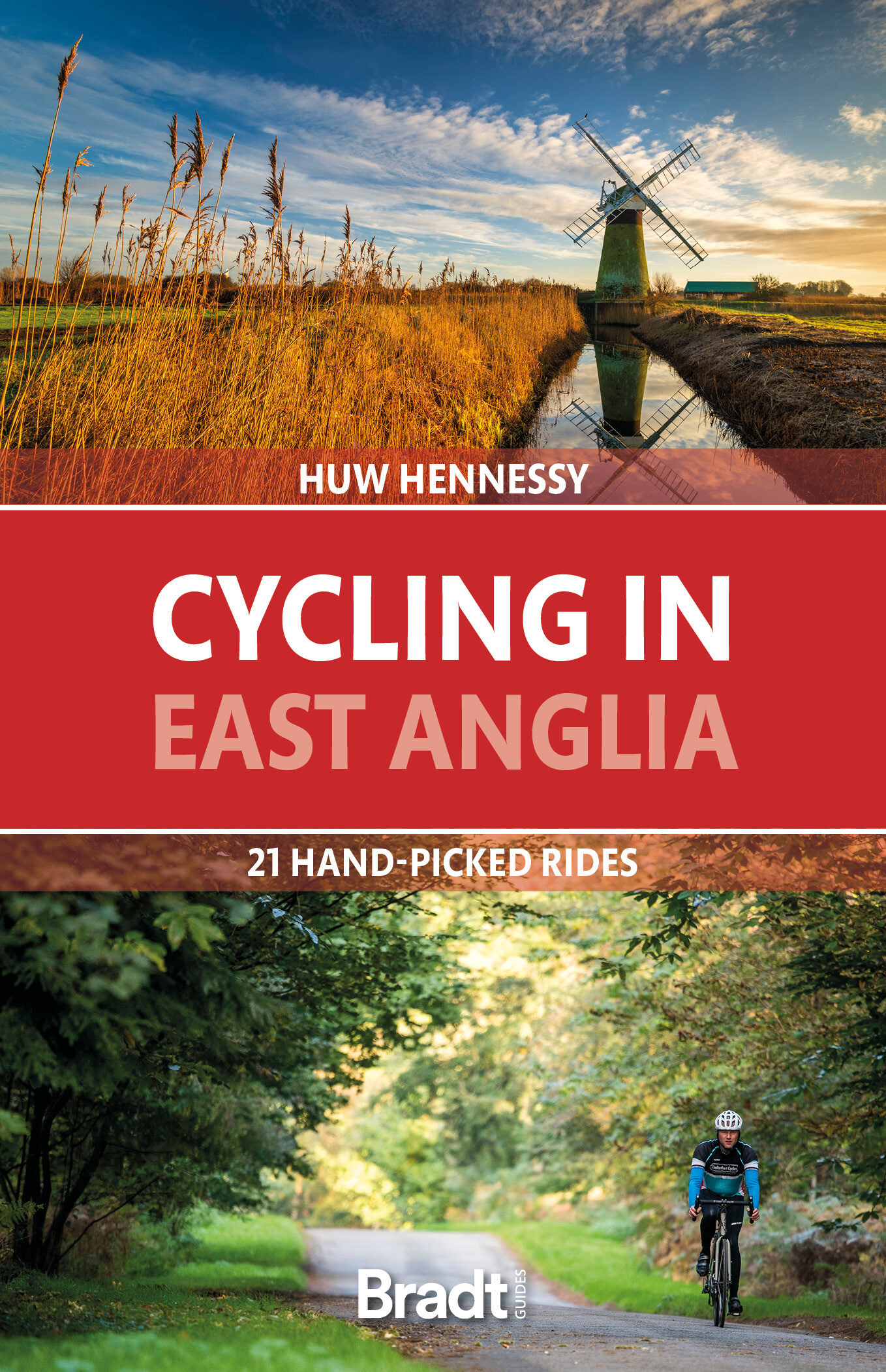
Cycling in East Anglia
21 hand-picked rides
by Huw Hennessy£12.99
Illustrated cycling guide to East Anglia: Norfolk, Suffolk, Cambridgeshire – 21 handpicked routes aimed at keen cyclists and families alike, including places such as Sandringham, Wells, Holkham, Norwich, the Norfolk Broads, Bungay, Thetford Forest, Ixworth, Diss, Southwold, Walberswick, Orford, Sutton Hoo, Ely, Newmarket and Graffham Water.
400 in stock
ISBN: 9781784778781
Published: 01st Apr 2022
Size: 130 X 198 mm
Edition: 1
Number of pages: 232
About this book
Following the same format as Bradt’s Cycling in Cornwall & the Isles of Scilly, this new cycling guide to East Anglia offers 21 routes for beginners and ‘leisure cyclists’, covering Norfolk, Suffolk and Cambridgeshire. Each ride includes comprehensive directions, as well as background features on local history, wildlife and culture. All are linked to OS Explorer maps and relevant National Cycle Network routes (NCN), and include National Grid Reference (NGR) coordinates. In addition, each route has been mapped on route planning and navigation app komoot, where readers can find detailed route insights including an elevation profile and waytype and surface information. Using the komoot app for iOS or Android, readers can also use their smartphones to navigate each route.
East Anglia, the snail-like bulge protruding off the back of the United Kingdom’s east coast, is a vast flatland of broads, fens and marshes, stretched out under a wide sky. Despite its proximity to London and the Midlands, and its continental ferry links, it is one of the quietest regions in the country. The ancient kingdom of the Angles is also its oldest inhabited region, from Paleolithic times to subsequent Viking and Roman invasions; its wetlands tamed with canals and windmills and built over with hundreds of medieval churches. With its level, traffic-free lanes, and network of dedicated cycle routes, this is also an ideal destination for exploring by bike.
Most of the rides are around 30 kilometres long, ideal for a half-day outing. 19 out of the 21 routes are loop circuits, making travel hassle-free, and several are adjacent so can be linked, for more energetic cyclists wanting a longer challenge. Places covered include Sandringham, Wells, Holkham, Norwich, the Norfolk Broads, Bungay, Thetford Forest, Ixworth, Diss, Southwold, Walberswick, Orford, Sutton Hoo, Ely, Newmarket and Graffham Water.
Its long, sandy beaches and traditional seaside resorts have made East Anglia one of the UK’s favourite holiday destinations. From rambles around sleepy villages to adrenalin-rush mountain bike circuits, , this guide will be packed with inspiration for cyclists of all ages and energy levels.
About the Author
Huw Hennessy is a lifelong cycling nut, and since childhood has pedalled as much as possible at every opportunity – from Paris to the Loire Valley after finishing his A-levels to freewheeling down the Andes when updating the Footprint Colombia Handbook a few years ago. Since moving to Devon in 2004, he has cycled all over southwest England. He knows East Anglia well, from 20+ years visiting family and friends in Norfolk and Suffolk; cycling the north coast, from Holkham Bay to Cromer, and through the Broads and back roads, from Halvergate, Norfolk to Bungay and Orford, in Suffolk.
Additional Information
Table of ContentsCONTENTS
INTRODUCTION
CYCLING: THE ESSENTIALS
HOW TO USE THIS BOOK
SANDRINGHAM LOOP
Start/end: Sandringham Distance: 17.8km Time: 1-1½hrs
Difficulty: 1 Highlights: Historic Royal Sandringham Estate and Castle Rising, churches, woodlands and picturesque villages
GREAT BIRCHAM LOOP
Start/end: Great Bircham Distance: 32.9km Time: 3hrs
Dfficulty: 1 Highlights: Rolling country lanes, through pretty villages and arable farmland; past Bircham Windmill, Houghton Hall and Deer Park
WELLS AND HOLKHAM LOOP
Start/end: Wells-next-the-Sea Distance: 28.9km Time: 2hrs
Difficulty: 1 Highlights: Holkham Nature Reserve, AONB coastal dunes and wildfowl nature reserve; off-road trails and historic country estate, Holkham Hall; detour to site of Warham, Iron Age fort; Wellsnext-the-Sea, resort and sandy beach on Holkham Bay
CLEY LOOP
Start/end: Cley Marshes Nature Reserve Distance: 26.3km Time: 2½hrs
Difficulty: 1 Highlights: Cley coastal marshes and heath, Letheringsett Watermill, Holt Country Park and passing near to
the North Norfolk Railway at High Kelling
NORTHERN BROADS:
HICKLING TO HORSEY LOOP
Start/end: Hickling Broad Visitor Centre Distance: 32.9km Time: 3½hrs
Difficulty: 1 Highlights: Hickling Broads Nature Reserve, Horsey coastal sand dunes and seal colony, Horsey Windpump, a huge Tudor barn and a rare medieval church
MARRIOTT’S WAY
Start/end: Norwich/Aylsham Distance: 30.8km Time: 3hrs
Difficulty: 1 Highlights: Along the peaceful Wensum Valley, following the route of the former railway line from Norwich to
Aylsham, dotted with Victorian steam memorabilia
REEDHAM BROADS LOOP
Start/end: Reedham Ferry Distance: 38.4km Time: 4hrs
Difficulty: 1 Highlights: Farmland, marshes and villages of the lower Yare Valley, historic churches and riverside Reedham
overlooking the Broads
SOUTHERN BROADS LOOP
Start/end: Reedham Ferry Distance: 34.7km Time: 4hrs
Difficulty: 2 Highlights: Peaceful Broads waterways and farmland, historic churches, windmills and stately gardens
BUNGAY SAINTS TRAIL
Start/end: Bungay Distance: 32.5km Time: 3½hrs
Difficulty: 2 Highlights: Bungay, ancient market town; historical churches in isolated hamlets and a World War II aviation museum
THETFORD FOREST
Start/end: High Lodge, Thetford Forest Distance: 16.6km Time: 2hrs
Difficulty: 2 Highlights: Forestry woodland; off-road cycling trails over level or gently rolling terrain; multi-activity centre,
from high-wire adventure to climbing walls and more
IXWORTH MILLERS’ TRAIL
Start/end: Ixworth Distance: 23.9km Time: 2½hrs
Difficulty: 1 Highlights: Historic windmills, a watermill, an Elizabethan manor and vineyard, and a wetland nature reserve
EYE TO DEBENHAM LOOP
Start/end: Eye Distance: 34.4km Time: 3½hrs
Difficulty: 1 Highlights: Historic market town Eye, chic Debenham, Wetheringsett vintage railway and mid-Suffolk’s rolling golden meadows
WALBERSWICK TO SOUTHWOLD LOOP
Start/end: Walberswick Distance: 31.3km Time: 3½hrs
Difficulty: 2 Highlights: Walberswick and Southwold, traditional seaside resorts; heath and countryside, picturesque villages and a historic windmill
ORFORD LOOP
Start/end: Orford Distance: 33.9km Time: 3½hrs
Difficulty: 1 Highlights: Historic Orford, arty Snape Maltings, a medieval church and a watermill, plus an optional red-graded MTB forest trail
SUTTON HOO AND RENDLESHAM FOREST LOOP
Start/end: Sutton Hoo Distance: 35.2km Time: 4hrs
Difficulty: 2 Highlights: Anglo-Saxon treasures at Sutton Hoo, Shingle Street beach, mountain biking in Rendlesham Forest
LAVENHAM LOOP
Start/end: Market Square, Lavenham Distance: 20.7km Time: 2½hrs
Difficulty: 1 Highlights: Lavenham, one of the best preserved medieval towns in East Anglia; sleepy villages and rolling
agricultural countryside
MOULTON LOOP
Start/end: Moulton Distance: 13.1km Time: 1½ hrs
Difficulty: 1 Highlights: Rolling meadows and woods, Fen villages, a stud farm, a medieval bridge and three great country pubs
NEWMARKET JOCKEYS’ TRAIL
Start/end: Moulton Distance: 45.7km Time: 4½hrs
Difficulty: 2 Highlights: Sleepy villages, rolling meadows, pristine stud farms, and Newmarket – world capital of horse racing
CAMBRIDGE TO ELY
Start/end: Cambridge-Ely Distance: 39.1km Time: 4hrs
Difficulty: 2 Highlights: Historic Cambridge University colleges, Anglesey Abbey, Ely Cathedral, Cam riverside path and Wicken Fen
HOUGHTON MILL LOOP
Start/end: Houghton MIll Distance: 28.3km Time: 3hrs
Difficulty: 1 Highlights: Historic Houghton watermill, riverside villages, and the Busway-Cycleway eco-route through Fen Drayton Lakes RSPB Nature Reserve
GRAFHAM WATER LOOP
Start/end: Marlow Park, Grafham Water Distance: 14.5km Time: 1½hrs
Difficulty: 1 Highlights: Lakeside trail fringed by wooded countryside; nature reserves and watersports
ACCOMMODATION
BIKE HIRE
FURTHER INFORMATION
ACKNOWLEDGEMENTS
INDEX
